Itaparica, November 2019
Itaparica is an island right in front of Salvador, in the Baia de Todos Os Santos, the largest bay in Brazil, with 56 islands!
We visited most of them, our favorite being Ilha do Bon Jesus, or as the locals call it, Ilha do Bon Suarez. Suarez is a guy who bought the island and build a beautiful million dollars house. His private security guards ensure that there is no crime around the anchorages of the island. But I'm digressing.
In Itaparica, there is a nice anchorage on the east side with a small marina. The highlight of Itaparica for us was that we could get mineral water in our tanks almost for free. The water from the Fonte de Bica is of excellent quality. Actually, the best we've found in Brazil.
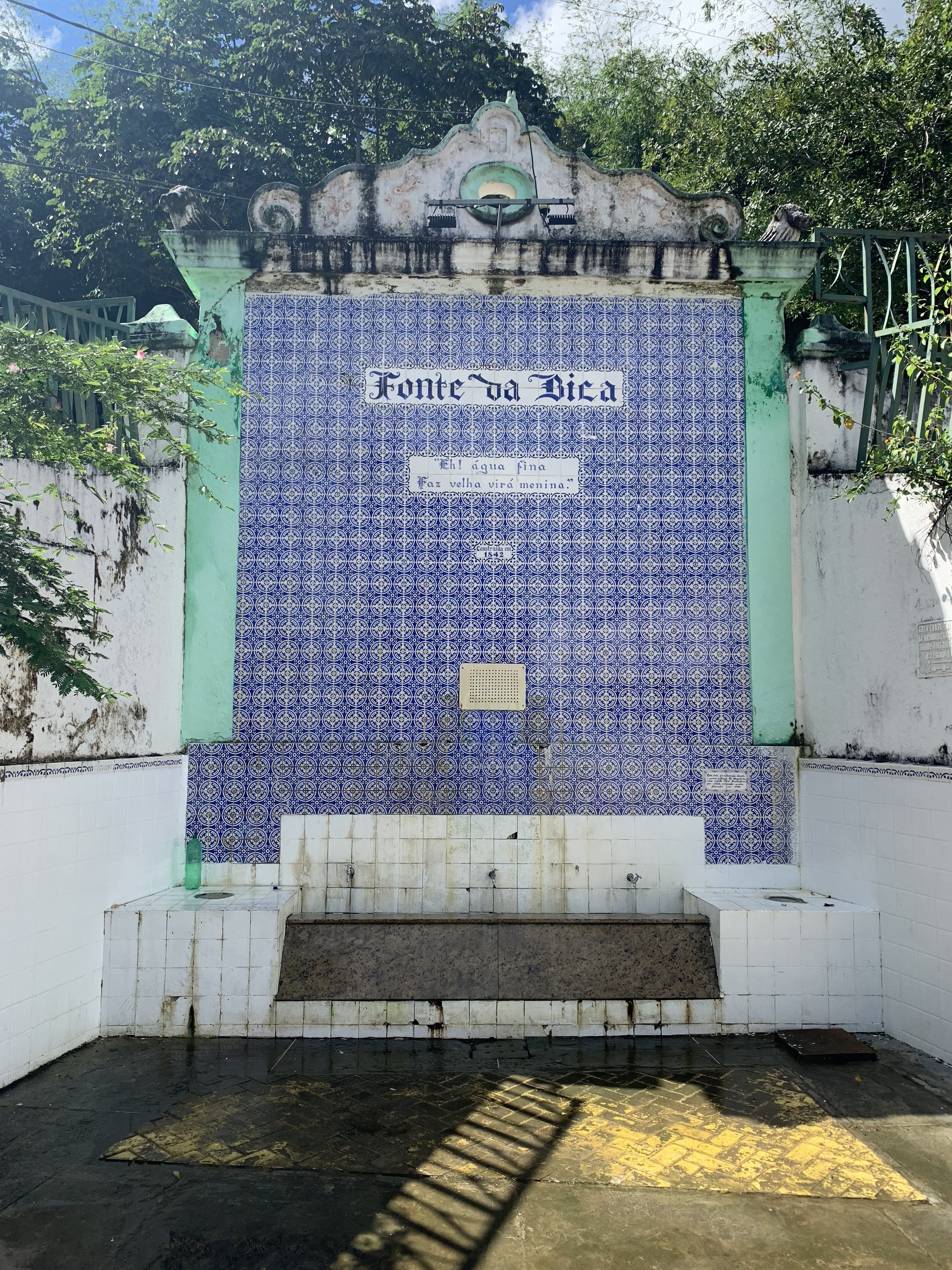
The Florentine Amerigo Vespucci arrived on the island on November 1, 1501. We are still learning about the Ruta do descubrimiento...
Another notable feature of this island is the degaussing station on the northern tip right in front of the Forte de Sao Lorenço. First time in my life I've seen one. Degaussing is the process of decreasing the magnetic field of ships invented during WWII, to avoid the Nazi naval mines. The degaussing station was built by the Brazilian Navy in the 70s. Why the Brazilians built one 30 years after the end of WWII is a mystery to me. Maybe someone who knows can post the answer?

Degaussing station
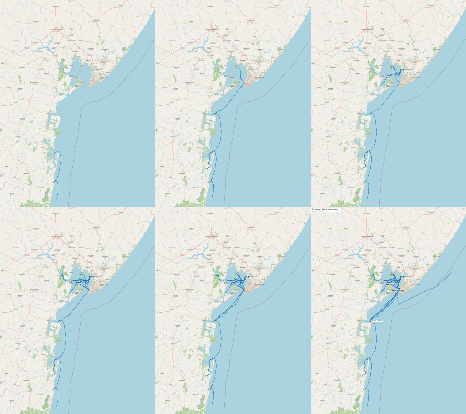
S/V Oroboro GPS track — Bahia de Todos os Santos — September–October 2019 • GPS data from Raymarine chartplotter • Map © OpenStreetMap contributors
Every anchorage — Brazil — Bahia de Todos os Santos, Sept–Oct 2019
Three stops exploring the 56 islands of the Bahia de Todos os Santos after our two-month base in Salvador.
| Stop | Date | Notes |
|---|---|---|
| Itaparica | Sept 2019 | East side marina · Fonte de Bica water |
| Ilha do Bom Jesus | Sept–Oct 2019 | Favorite island of the 56 |
| Morro de São Paulo | Oct 2019 | Terceira Praia · through reef |
Anchorage maps
Zoomed-in charts of each stop in the Bahia de Todos os Santos, with GPS track overlay.
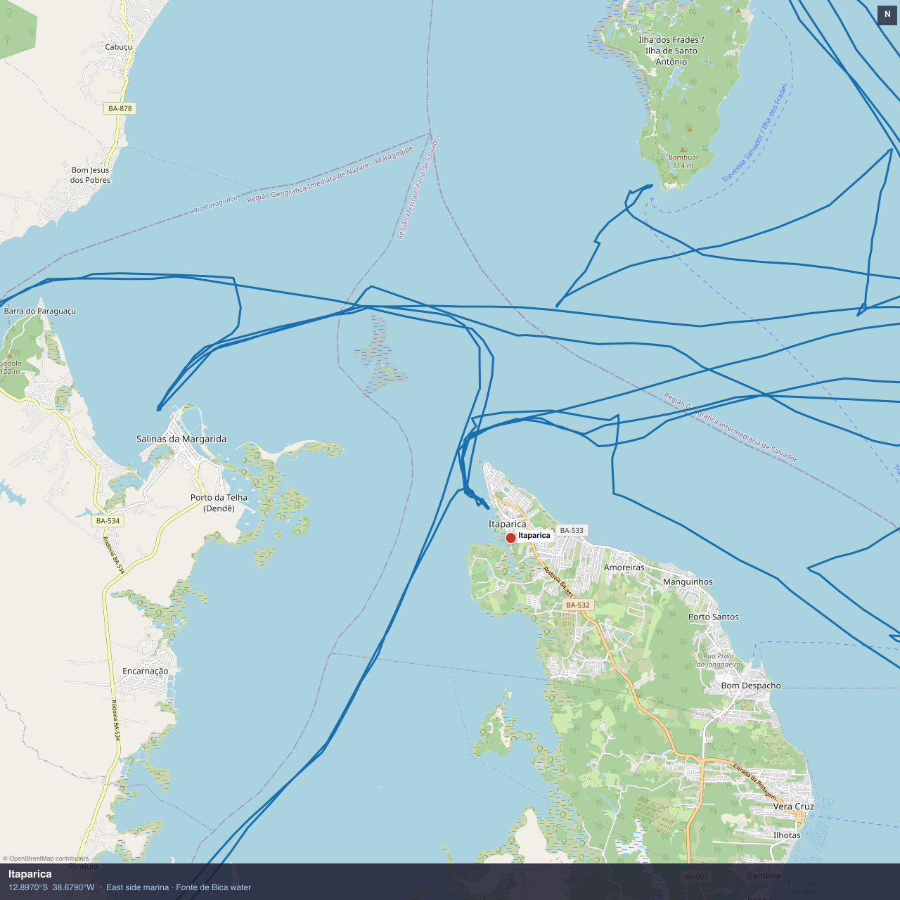
Itaparica
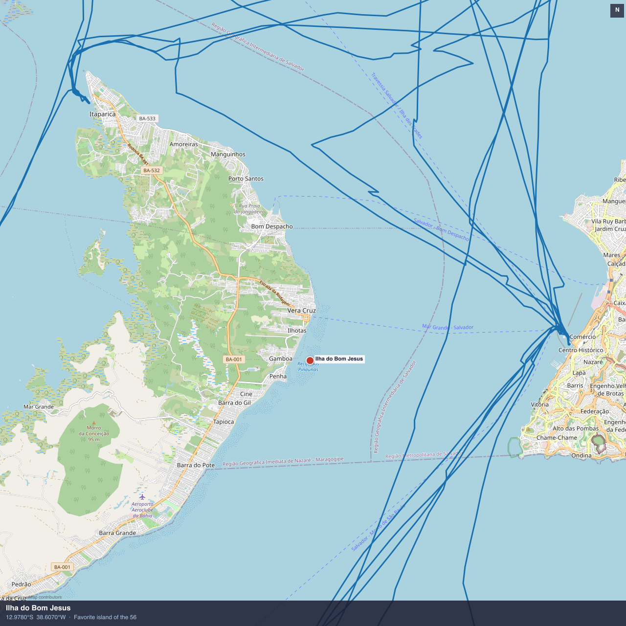
Ilha do Bom Jesus
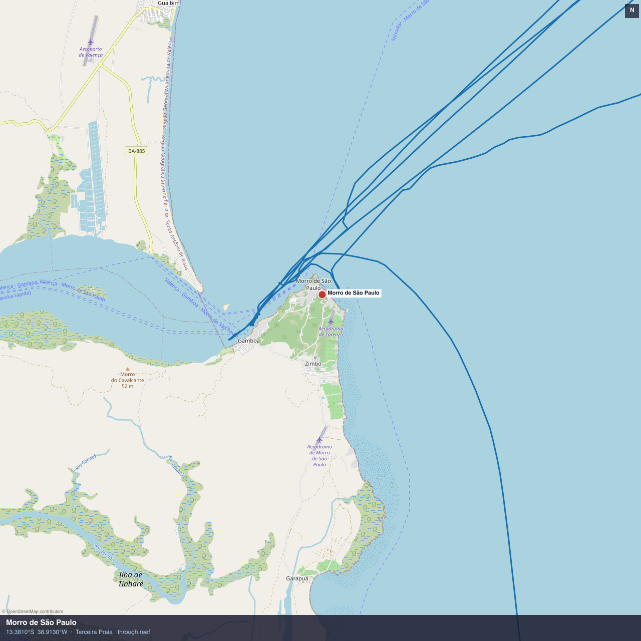
Morro de São Paulo
Map data © OpenStreetMap contributors. GPS tracks from Raymarine chartplotter, archived September–October 2019.